
Every stone located
Detected stones are mapped to geospatial coordinates and exported as GPX waypoints.
Detect, map, and manage stones across agricultural fields automatically, creating accurate stone maps that make removal more efficient and easier to plan.
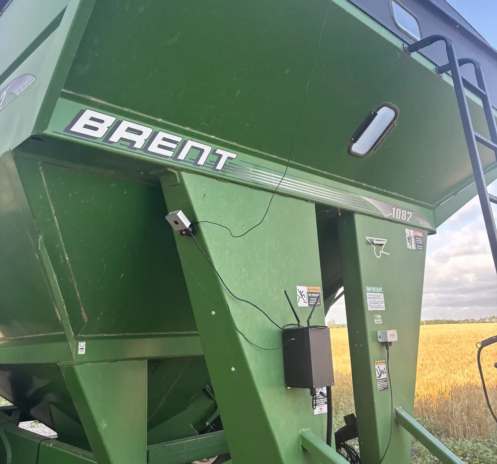
Stones reach your map two ways: the AI unit finds and measures them on its own while you work, and the driver marks anything else with a button from the cab. Both land in the same portal, and the field screen turns it into a route.
Finds and measures each stone while you work. Magnetic mount, moves between machines in minutes.
A three-button keypad logs a stone by hand, one button per level of risk.
Every stone on your field, sized and located. Decide what is worth picking and mark stones as removed.
Turns the map into a route, so the driver goes stone to stone instead of searching.
Both setups put your stones on the same map and give your crew a route to pick from. The difference is who finds the stones in the first place.
The unit is magnetic and the logger plugs into USB, so all you need is a 12 V socket. Register your fields in the SoilMate portal once.
Nothing to switch on and no extra passes. Seed, cultivate or harrow as usual and the stones are recorded as you go.
Data is processed on the unit into precise GPX waypoints, and your map is ready within 24 hours.
Review the stones in the portal, then send the map to a Garmin, a field screen or any other navigator.
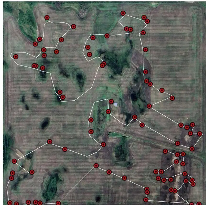
Knowing where stones are located before removal helps reduce unnecessary driving and makes field work more systematic. Switch between the two approaches to see the difference.
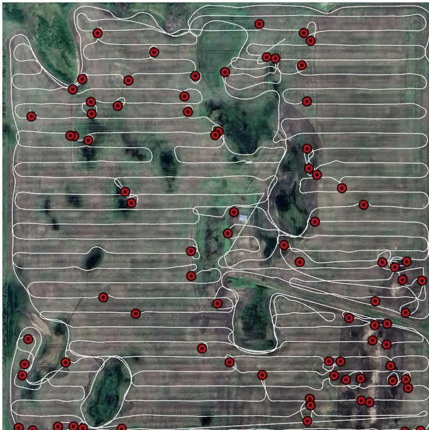
Driving distance relative to a full field search. Following the map covers the same stones in 6.0× less driving.
Detected stones are mapped to geospatial coordinates and exported as GPX waypoints.
In our quarter-section trial the same stones were reached with one-sixth of the driving, so the crew spends the day lifting stones rather than looking for them.
You know where the big stones are before the drill, the swather or the combine finds them.
Stones picked and stones remaining, field by field, season after season — so stone management becomes a plan instead of a reaction.
acres mapped with StoneSight during the 2024–2026 seasons.
Order a box and register your fields, and by the time you are picking, every stone is already located. Early booking for the 2027 season is open now — here is what you get.
A new sensor built for the 2027 season, with enhanced stone measurement precision.
Detection that keeps working after dark, so mapping isn't limited to daylight passes.
Build and run a stone management strategy across fields and seasons.
StoneSight is looking for local partners in Manitoba, Saskatchewan and Alberta, as well as partnerships with agricultural machinery producers and distributors.
Tell us how many acres you farm and which machinery you run — we'll come back with a setup and a price.